Introduction
Wildfires already terrify with their speed and destruction. But some fires escalate into something far more otherworldly — pyrocumulonimbus clouds, or pyroCb for short. These explosive fire clouds punch into the sky like volcanic eruptions, warping the atmosphere and rewriting the rules of firefighting.
If you’ve never heard of them, you’re not alone. But as wildfires get hotter and more intense due to climate change, pyroCbs are becoming more common — and more dangerous. Let’s break down what they are, how they form, and why they matter.
What Is a Pyrocumulonimbus Cloud?
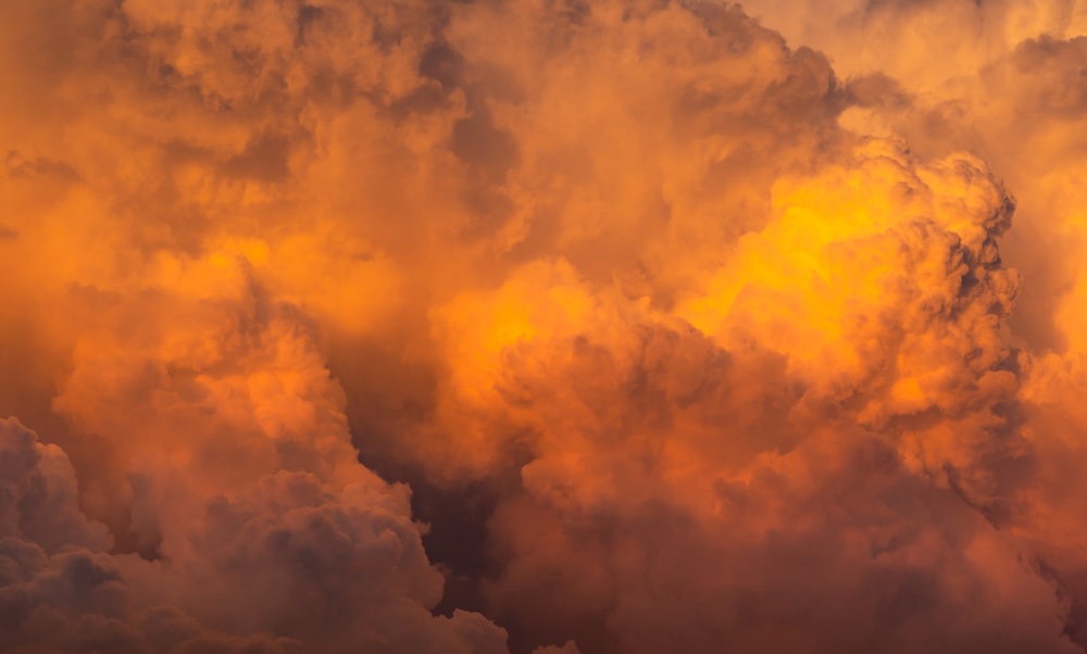
A pyrocumulonimbus cloud is essentially a thunderstorm born of fire.
It forms when an intense wildfire or volcanic eruption produces enough heat to send smoke, ash, and vapor violently upward into the atmosphere. As that hot air rises, it cools and condenses into a towering cumulonimbus cloud — just like a regular thunderstorm — but driven by fire instead of weather.
The result? A colossal, dark column of smoke and ash that can stretch miles into the sky, sometimes even piercing the stratosphere.
How PyroCbs Form
Several ingredients are needed to create one of these monsters:
- Extremely hot fire generating intense upward heat (usually a megafire)
- Dry, unstable air above the fire, allowing for vertical movement
- Moisture in the vegetation or atmosphere, which vaporizes and helps form the cloud
Once the system gets going, it’s self-reinforcing. The fire fuels the updraft, the updraft feeds the cloud, and the cloud generates wind and lightning that can feed new fires.
Why They’re So Dangerous
Pyrocumulonimbus clouds aren’t just eerie to look at — they introduce extreme unpredictability and chaos to wildfire situations.
1. They Generate Lightning
PyroCbs produce dry lightning — bolts that strike the ground without rain, often far from the fire’s origin. These can ignite entirely new wildfires, starting spot fires miles away. In rare cases, they’ve started dozens of fires at once.
2. They Cause Fire Tornadoes
Yes, actual tornadoes made of fire. The violent updrafts can cause rotating columns of flame, smoke, and debris that spin across the landscape. These fire whirls are unpredictable, fast-moving, and can tear through terrain that firefighters thought was safe.
3. They Shift Winds Without Warning
When the cloud collapses or changes shape, it can create downdrafts and erratic wind behavior, trapping firefighters or pushing flames toward homes or escape routes. This can lead to catastrophic outcomes in minutes — or even seconds.
4. They Carry Smoke Across Continents
Because these clouds rise so high, their smoke enters the upper atmosphere and can travel thousands of miles, affecting air quality in cities that may never see the fire itself. In 2021, smoke from Canadian wildfires reached Europe via pyroCb plumes.
5. They’re Nearly Impossible to Predict or Control
Once a fire spawns a pyroCb, it essentially becomes a self-sustaining, weather-generating system. Firefighters often must pull back and re-strategize. In some cases, the only option is to wait for the system to collapse.
Not Just a Western U.S. Problem
Pyrocumulonimbus clouds have been observed on every fire-prone continent:
- Australia: The 2019–2020 Black Summer fires generated massive pyroCb events
- Canada: PyroCbs in 2023 pushed smoke into the U.S. East Coast
- Russia & Siberia: Seen during Arctic fires that shocked the global scientific community
- Greece & Turkey: Fire-driven thunderclouds created new blaze zones in 2021
As climate change drives hotter, drier conditions, more fires are reaching the intensity needed to spawn these clouds.
Should We Be Worried?
Yes — because pyroCb clouds signal a new level of wildfire behavior. They’re no longer isolated events — they’re part of an emerging pattern of fire-weather interactions that can:
- Overwhelm emergency services
- Disrupt global air quality
- Jeopardize air traffic
- Accelerate ecosystem collapse
But knowing about them is the first step. Governments, meteorologists, and firefighting agencies are starting to track pyroCbs as critical warning signs for fire escalation.
What We Can Do
While individuals can’t stop a pyroCb mid-formation, we can take steps that reduce their likelihood:
- Support prescribed burns and fuel reduction to prevent mega-intense wildfires
- Protect wetlands and forests that retain moisture
- Back clean energy policy that addresses fossil-fuel-driven warming
- Educate communities about wildfire readiness
As scary as they sound, pyrocumulonimbus clouds are a symptom — not the cause. They’re Earth’s way of showing us that heat, fuel, and neglect make for dangerous skies.
Final Thought
If we don’t want wildfires making their own weather, we need to make better climate decisions down here on Earth. Because once fire starts touching the sky, we’ve already lost control.


